
- aera 795
- Yoke mount
- DC cigarette adapter 12/24 volt cradle
- Home A/C cradle dock
- GA 25 remote antenna with suction cup mount
- USB cable
- Carrying case
- Touchscreen cleaning cloth
- Quick reference guide
- Complimentary single database update
- Pilot’s Guide e-version (viewable on the document viewer)
Garmin
Garmin in Islamabad – Pakistan
-
Garmin GPS eTrex 30x
eTrex 30x is our upgraded version of the popular eTrex 30, with enhanced screen resolution for a more readable display and internal memory expanded to hold more maps. It retains the ease-of-use, durability, and affordability that eTrex is legendary for and can also be used on ATVs, bicycles, boats, cars or hot air balloons.
₨34,000.00Garmin GPS eTrex 30x
₨34,000.00 -

Garmin GPS 12H
Garmin GPS 12H
- Physical dimensions: 2.6” x 6.0” x 1.2” (6.6 x 15.2 x 3.0 cm)
- Display size: 2.6” diagonal (6.6 cm)
- Display type: 4 level gray LCD
- Weight: 7.16 oz. (203.11 g) with AA batteries (not included)
- Interface: USB and Serial
- Storage: 1,000 waypoints and 100 tracks
- Battery life: Up to 18 hours with 2 AA batteries (not included)
₨23,000.00Garmin GPS 12H
₨23,000.00 -
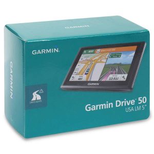
Garmin Drive 50 GPS
General
Physical dimensions 5.5″W x 3.3″H x .8″D (14.0 x 8.4 x 2.0 cm) Display size 4.4″W x 2.5″H (11.1 x 6.3 cm); 5.0″ diag (12.7 cm) Display resolution 480 x 272 pixels Display type WQVGA color TFT with white backlight Weight 6.0 oz (170.8 g) Battery rechargeable lithium-ion Battery life up to 1 hour Maps & Memory
Preloaded street maps Storage and Power Capacity microSD™ card (not included) Navigation Features
Lane assist with junction view (displays junction signs) Speed limit indicator (displays speed limit for most major roads in the U.S. and Europe) Additional
Additional - Trip planner: yes
- Trip log: yes
- Powered magnetic mount: no
- Garmin Real Directions™ landmark guidance: yes
- Foursquare POIs: yes
₨33,000.00Garmin Drive 50 GPS
₨33,000.00 -
Garmin aera 795
Garmin aera 795
₨299,000.00Garmin aera 795
₨299,000.00 -
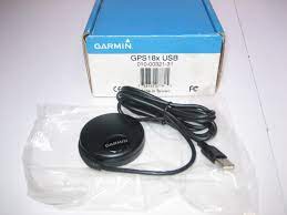
Garmin GPS 18x USB
Garmin GPS 18x USB
The GPS 18x is an OEM, high-sensitivity GPS sensor for use in automotive, fleet vehicle, and electronics applications that require a small, highly accurate GPS receiver.
Use in Small Spaces
This high-sensitivity, 12-parallel-channel, WAAS-enabled GPS receiver is available in CMOS-level serial or USB 2.0 full-speed versions and comes with an integrated magnetic base. The puck-like receiver is 2.4″ (6.1 cm) in diameter and weighs just a few ounces, making it an ideal solution for applications where space is at a premium.
Choose Your Connection Type
The GPS 18x is offered in 3 different cable configurations. All 3 versions of the GPS 18x come complete with non-volatile memory for storage of configuration information, a real-time clock and raw measurement output data for sophisticated customer applications.
- GPS 18x PC — has DB-9 pin serial connector with a 12 V cigarette lighter adapter; can output data in NMEA 0183 format (industry standard) or proprietary Garmin format.
- GPS 18x USB — has A-style USB connector, compatible with USB 2.0 and 1.1 full-speed hosts; can output data in Garmin proprietary format only.
- GPS 18x LVC — has bare wire for connection to a variety of applications; can output data in NMEA 0183 format (industry standard) or proprietary Garmin format; provides a pulse-per-second logic-level output with a rising edge aligned to within 1 microsecond of UTC time.
The GPS 18x OEM is a high-sensitivity GPS sensor that replaces the GPS 18 OEM.
₨15,000.00Garmin GPS 18x USB
₨15,000.00 -
Garmin GPSMAP® 64s
- 2.6″ sunlight-readable color screen
- High-sensitivity GPS and GLONASS receiver with quad helix antenna
- 4 GB of internal memory and a microSD™ card slot
- 250,000 preloaded caches for paperless caching
- Garmin GPSMAP 64s
₨45,000.00Garmin GPSMAP® 64s
₨45,000.00 -
Garmin GPSMAP® 64
- 2.6″ sunlight-readable color screen
- High-sensitivity GPS and GLONASS receiver with quad helix antenna
- 4 GB of internal memory and a microSD™ card slot
- 250,000 preloaded caches for paperless caching
- Garmin GPSMAP 64
₨39,500.00Garmin GPSMAP® 64
₨39,500.00 -
Garmin GPS eTrex 20x
Greater resolution with 240 x 320 display pixels for improved readability
Internal memory expanded to hold more maps
High-sensitivity, WAAS-enabled GPS receiver with HotFix® and GLONASS support
2.2-inch color display
Worldwide basemap with shaded relief₨24,500.00Garmin GPS eTrex 20x
₨24,500.00 -
Garmin GPS eTrex 10
Rugged Handheld GPS with Enhanced Capabilities
Worldwide basemap
2.2″ monochrome display, easy to read in any light
GPS and GLONASS satellites for faster positioning
Paperless geocaching
25-hour battery life with 2 AA batteriesGarmin GPS eTrex 10
₨47,500.00Garmin GPS eTrex 10
₨47,500.00